Bihar mandates geospatial clearance from BIRSAC for all infrastructure projects costing over Rs. 50 crore to boost efficiency and transparency.
Patna: In a significant move towards data-driven and scientific planning, the Bihar government has mandated geospatial approval for all infrastructure projects with an estimated cost of more than Rs. 50 crore.
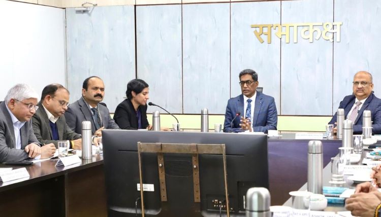
Pratyay Amrit, the chief secretary of the state, presided over a high-level review meeting of the Bihar Remote Sensing Application Centre (BIRSAC) where the decision was made. Top administrators from several departments were there, along with senior officials such as Science, Technology, and Technical Education Secretary Dr. Pratima and Development Commissioner Mihir Kumar Singh.
Every detailed project report (DPR) for major infrastructure projects must obtain technical clearance from BIRSAC prior to receiving financial approval under the new policy. According to the chief secretary, the development of Bihar’s infrastructure now requires the application of geospatial analytics.
He emphasized the significance of formally integrating BIRSAC’s services into the state’s infrastructure planning framework, saying, “Geospatial inputs must be integrated at the planning stage itself to avoid technical, administrative, and land-related complications later.”
Officials clarified that geospatial analytics would be a required DPR add-on for projects costing at least Rs. 50 crore. For BIRSAC’s services, departments will only have to pay 0.25% of the project’s overall cost. This change is meant to bolster the organization’s finances without adding to the state coffers.
Also read: Nitish Kumar Attends Makar Sankranti Dahi-Chura Feast at Vijay Sinha’s Residence in Patna
The discussion went over the work that BIRSAC has been doing, which includes mapping natural resources and government assets using geospatial inventories, monitoring and managing disasters, providing spatial data assistance for development planning, and building geospatial databases at the village level.
Additionally, the government is working with the Bhaskaracharya Institute for Space Applications and Geo-Informatics (BISAG-N) to develop a digital tool. Better alignment planning and more precise project assessments will be made possible by the tool’s assistance in creating DPRs using data from the PM Gati Shakti portal.
According to officials, the approach would assist identify possible obstacles including property acquisition, forest clearing, and drainage concerns early on, prevent duplication of effort, and save expenditures. Additionally, it is anticipated to assist with environmental monitoring, including tracking activities such as stubble burning, and disaster management.
Departments concurred that the new system would improve the sustainability, efficiency, and transparency of infrastructure projects. The top secretary gave all departments instructions to improve interdepartmental coordination and provide project status updates on the portal on a regular basis.
As a pillar of Bihar’s infrastructure planning for the future, he also acknowledged the accomplishments of BIRSAC and emphasized the need to further develop the organization’s technical and human resource capabilities.